
Here is a link to the Scuppernong Springs Self-Guided Nature Trail brochure Scuppernong Springs Nature Trail Brochure. It includes a map of the Nature Trail (shown below) and a description of the highlights you will see along the way.
 Here are two topographical views.


Here are two maps of the buildings comprising the Old Hotel/Cheese Factory/Mill site. Ron Kurowski, from the Kettle Moraine Natural History Association, supplied them to Robert Duerwachter for use in his excellent book THE PONDS OF THE SCUPPERNONG.


Here is an image from 1941 captured from the Waukesha GIS service.
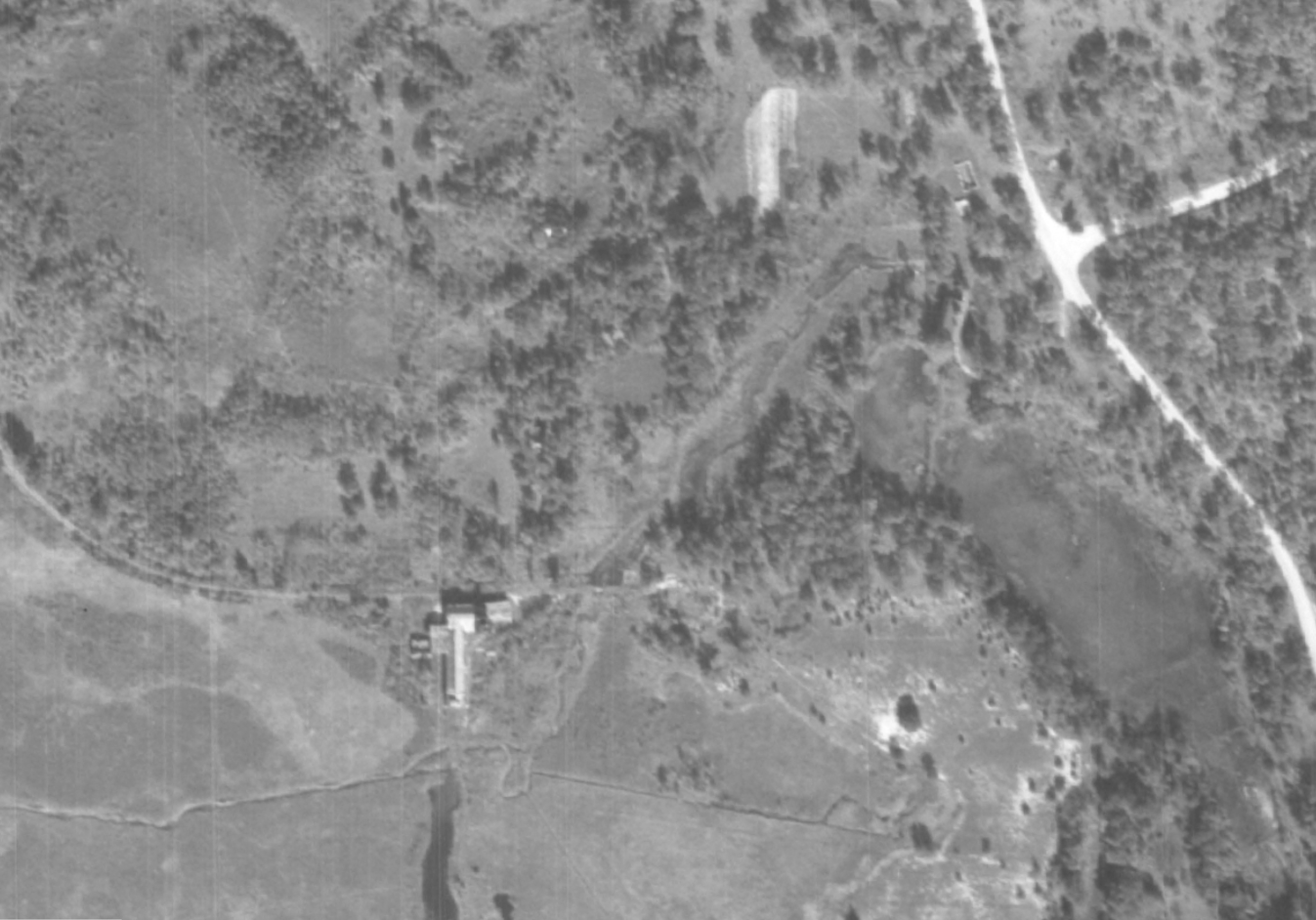 Ben Johnson supplied this picture from the SEWRPC records of The Springs in 1937.

He zoomed in to get these three pics (Thanks Ben!)


Check out this view of the area courtesy of Google Maps. You can use the Marl Pits to help orient yourself.
Also, check out the Wisconsin Wetlands Association (WWA) Wetland Gems Page SE-10 Scuppernong River Area for a nice overview.

Pingback: Indian Springs Buckthorn Clearing Update | Scuppernong Springs Nature Trail
Pingback: Water Works and Odds and Ends | Scuppernong Springs Nature Trail
Pingback: Brush Piling by the Scuppernong Spring | Scuppernong Springs Nature Trail
Pingback: Ground Water Monitoring Project at the Springs | Scuppernong Springs Nature Trail
Pingback: The Hatching House Springs | Scuppernong Springs Nature Trail
Pingback: Mother Nature Naked | Scuppernong Springs Nature Trail
Pingback: Oaken Word | Scuppernong Springs Nature Trail
Pingback: Scuppernong Springs Meadows | Scuppernong Springs Nature Trail
Pingback: Spring Labor Days | Scuppernong Springs Nature Trail
Pingback: The Tibby Line | Scuppernong Springs Nature Trail
Pingback: Open House | Scuppernong Springs Nature Trail
Pingback: Buckthorn Man Accepts Bitcoin! | Scuppernong Springs Nature Trail
Pingback: The Fish Hatchery Springs | Scuppernong Springs Nature Trail
Pingback: Winter Break | Scuppernong Springs Nature Trail
Pingback: Blind Traveler | Scuppernong Springs Nature Trail
Pingback: Oakological Succession | Scuppernong Springs Nature Trail
Pingback: Scuppernong River | Miles Paddled
Pingback: Scuppernong River – My WordPress Site