Evan Thomson Building
Evan Thomson Building is a hospital building in Brisbane, Queensland. Evan Thomson Building is situated close to Auchenflower railway station and Wesley Hospital.Notable Places in the Area
Wesley Hospital
Hospital

Photo: Commander Keane, Public domain.
The Wesley Hospital is a private hospital located in the suburb of Auchenflower in Brisbane, Queensland, Australia.The hospital currently has over 530 beds and offers a large range of clinical services. Wesley Hospital is situated 100 metres southeast of Evan Thomson Building.
Auchenflower railway station
Railway station

Photo: TravellerQLD, CC BY-SA 3.0.
Auchenflower railway station is located on the Main line in Queensland, Australia.
Toowong Memorial Park
Park
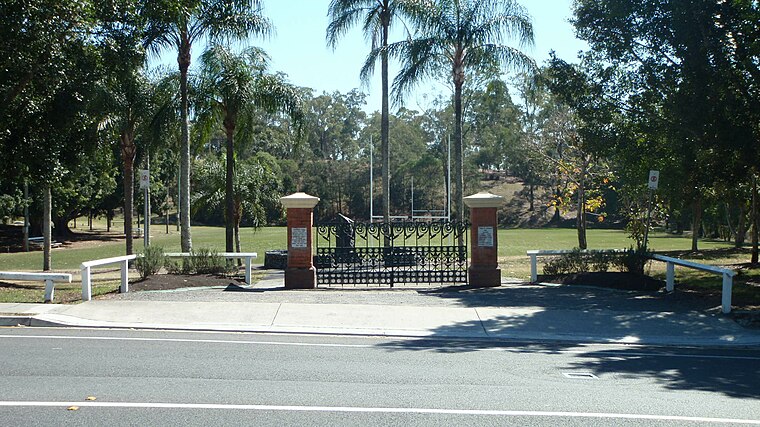 Toowong Memorial Park is a heritage-listed memorial and park at 65 Sylvan Road, Toowong, City of Brisbane, Queensland, Australia. Toowong Memorial Park is situated 440 metres southwest of Evan Thomson Building.
Localities in the Area
South Bank
Neighborhood

Photo: willislim, CC BY-SA 2.0.
South Bank is a cultural, social, educational and recreational precinct in Brisbane, Queensland, Australia.
Brisbane
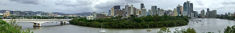 Brisbane is the state capital of Queensland. Large enough to be cosmopolitan yet small enough…
Clarence Corner
Hamlet

Photo: Wikimedia, Public domain.
Clarence Corner is the junction of Stanley Street and Annerley Road in Woolloongabba/South Brisbane in Brisbane, Queensland, Australia. Clarence Corner is situated 3½ km east of Evan Thomson Building.
Evan Thomson Building
- Type: Hospital building
- Categories: building and health care
- Location: Brisbane, Queensland, Australia, Oceania
- View on OpenStreetMap
Latitude
-27.4773° or 27° 28' 38" southLongitude
152.99717° or 152° 59' 50" eastLevels
9Open Location Code
5R4JGXFW+3VOpenStreetMap ID
way 511404191OpenStreetMap Feature
building=hospitalEvan Thomson Building Satellite Map
© OpenStreetMap, Mapbox and Maxar
Landmarks in the Area
- McIlwraith ParkPark, 140 metres west
- McIlwraith Croquet ClubRecreation area, 140 metres west
- Moorlands ParkPark, 180 metres south
- NAB Stadium180 metres southwest
Places in the Area
- Public car parkParking lot
- AuchenflowerRailway stop
- Sandford Jackson BuildingHospital building
- Wesley Medical CentreHospital building
Popular Destinations in Queensland
Discover Brisbane, Gold Coast, Sunshine Coast and Cairns.
Escape to a Random Place
Discover other destinations in the world.
About Mapcarta. Thanks to Mapbox for providing amazing maps. Data © OpenStreetMap contributors and available under the Open Database License. Text is available under the CC BY-SA 4.0 license, excluding photos, directions and the map. Photo: Wikimedia, CC0.