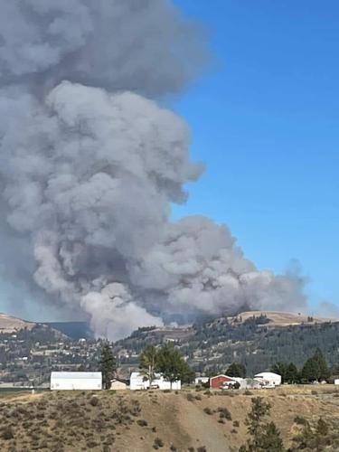


DAVNEPORT, Wash. - The Seven Bays Fire was 100% contained by Monday, according to the Department of Natural Resources. The fire had burned approximately 1,232 acres northwest of Davenport.
No evacuations or road closures were in place.
Last Updated: Sept. 13 at 11:15 a.m.
The Seven Bays Fire was 65% contained by Saturday morning, according to the Department of Natural Resources. The fire had burned approximately 1,232 acres northwest of Davenport.
No evacuations or road closures were in place, and 151 firefighters were assigned to the fire.
Last Updated: Sept. 10 at 8:30 a.m.
The Seven Bays Fire was estimated to have burned 1,000 acres as of Wednesday morning, according to an update from the Department of Natural Resources (DNR). The fire was 15% contained.
The Lincoln County Sheriff's Office (LCSO) also shared Miles-Creston road has now reopened.
Dozer lines have been established around all sides of the fire, and crews will focus on directly attacking the fire Wednesday and Thursday.
LCSO said the outlook was "very good, and crews plan to remain in the area through the first part of this weekend."
The fire started late in the afternoon Sept. 4, and initially caused level 3, "go now," evacuations, which have since been lifted.
Updated: Sept. 7 at 7:15 a.m.
In an update from the Lincoln County Sheriff's Office, evacuations for the Seven Bays Fire near Davenport have been lifted.
Miles-Creston Road remains closed right now, but crews say it should reopen Tuesday evening.
Updated: Sept. 6 at 2:45 p.m.
Evacuations remained in place for a third day for the Seven Bays Fire near Davenport Tuesday morning. The fire was estimated to have burned 1,000 acres and it is 0% contained.
Level 3 evacuations, meaning "go now," are in effect in the area around the fire, north to Hume, west to Miles Creston, south to Reinbold and east to Highway 25.
Miles Creston road is closed during the day, and Reinbold and Mule Ranch roads are open to local traffic only.
The cause of the fire remained under investigation.
Updated: Sept. 6 at 9 a.m.
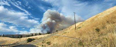
The Seven Bays Fire northwest of Davenport ignited Sunday night around 8:30, and crews remain on-scene to try and contain it today.
A Type 3 management team from the Washington Department of Natural Resources (DNR) assumed command of the fire on Sept. 5. Some crews have been redirected to Reinbold Rd. to reinforce lines in that location this afternoon.
An estimated 1,000 acres have been burned, though this number may change as a more official measurement is made.
Seven Bays Fire


Closures and evacuations
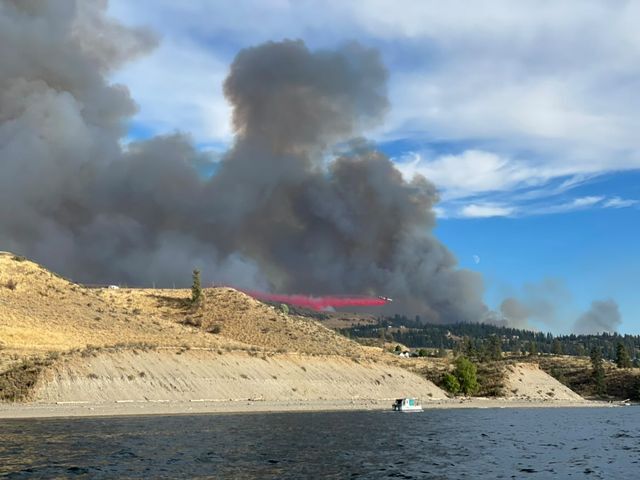
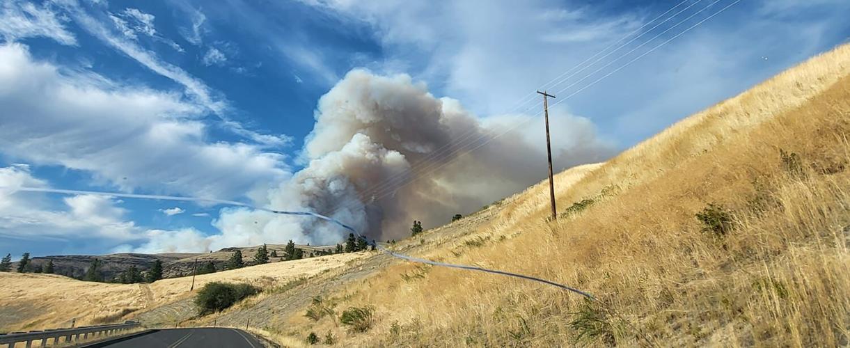
Additional air resources have been ordered to the area, and crews ask recreators to avoid the Ft. Spokane and Two Rivers area of Lake Roosevelt so air support can safely fill for water drops. The areas of the lake used may expand as more resources are added, so those on the water should be mindful of their activity.
Miles Creston Rd. remains closed between Hawk Creek Rd. and Seven Bays. A danger of falling trees and high activity of crews means drivers should remain away until it is reopened.
Hume Rd. is open, though drivers should be vigilant of changing conditions and of crews in the area.
Evacuations remain at Level 3 (Leave now!) for those north to Hume, west to Miles Creston, south to Reinbold, and east to Highway 25. The rest of the area is under Level 2 alert (Get set).
Updated: Sept. 5 at 3 p.m.
Level 3 evacuations remained in place Monday morning for a fire near Davenport.
Level 3, "leave now," evacuations remained in place Monday morning for the Seven Bays fire northwest of Davenport, according to Department of Natural Resources (DNR) public information officer Guy Gifford.
The evacuations are in place north to Hume, west to Miles Creston, south to Reinbold and east to Highway 25.
Gifford said the fire was still estimated to be 700-800 acres, but there is low confidence in that number. Crew are working on a better estimate.
The fire was 90% trailed and 0% contained, burning through stubble and timber. Fire activity has been lower than Sunday. Gifford said 120 firefighters are set to respond to the fire today, including 15 engines and 3 dozers. A helicopter continued to respond to the fire, and more air resources may be deployed if necessary.
Highway 25 has reopened, but some side roads may close depending on fire activity.
The cause of the fire remains under investigation.
Updated Sept. 5 at 8:45 a.m.
Lincoln County Sheriff's Office (LCSO) reports a wildfire is burning north of Davenport between Miles Creston Road, Seven Bays, and Hawk Creek.
Level 3 (GO NOW!) evacuations have been issued to residents on Highway 25 from Mule Ranch Road to Reinbold Road, and residents should leave that area immediately.
Level 2 (Get Set) evacuations are now in place for residents along HWY 25 from Mule Ranch Rd. to Egypt Loop to the North, with the eastern boundary being the ends of Egypt Loop. Those in the area should be ready to leave at a moment's notice.
Seven Bays Fire
Aircrafts performing water drops, and LCSO asks the public to avoid the area from HWY 25 from Mule Ranch Rd. north to Hume Rd., west to Miles Creston Rd., as well as Lake Roosevelt.
HWY 25 is closed down at Porcupine Bay Rd. Traffic will be redirected back towards Davenport. Avoid the area.
Traffic is closed to thru traffic from Miles Creston Rd. to Mule Ranch Rd. Residents may leave, but entry is prohibited.
Updated: Sept. 4 at 6:30 p.m.

LCSO reported the Hawk Creek campgrounds had previously been evacuated already.
The fire is moving north at the moment. LCSO asks residents nearby to be aware of their surroundings and evacuate immediately if they feel unsafe.
The estimated size of the Seven Bays Fire is 500 acres per WildCAD, but an official size has not been released. The cause is not known.
Updated: Sept. 4 at 5:45 p.m.

A wildfire has broken out northwest of Davenport
From the Lincoln County Sheriff's OfficeCrews are responding to a wildfire northwest of Davenport.
The fires is burning in the area of Miles Creston Road. The Lincoln County Sheriff's Office is asking that you stay away from the area while crews respond.

This is a developing story. Please check back for updates.


