

South Downtown I-405 Access Study: Alternatives Evaluation Open House
Thank you for your interest in the South Downtown I-405 Access Study. The consultation period for this online open house has concluded.
2/19/21: The open house is closed.
Welcome! This is the city’s second online open house to gather public feedback on interchange alternatives. Our goal is to ease traffic congestion and help people get where they need to go in south Downtown Bellevue, whether they are walking, biking, riding transit or driving. This online open house closes at 5 p.m. on Friday, Feb 19.
Thank you for participating in this online open house to learn about our analysis findings and share input on five remaining alternatives.
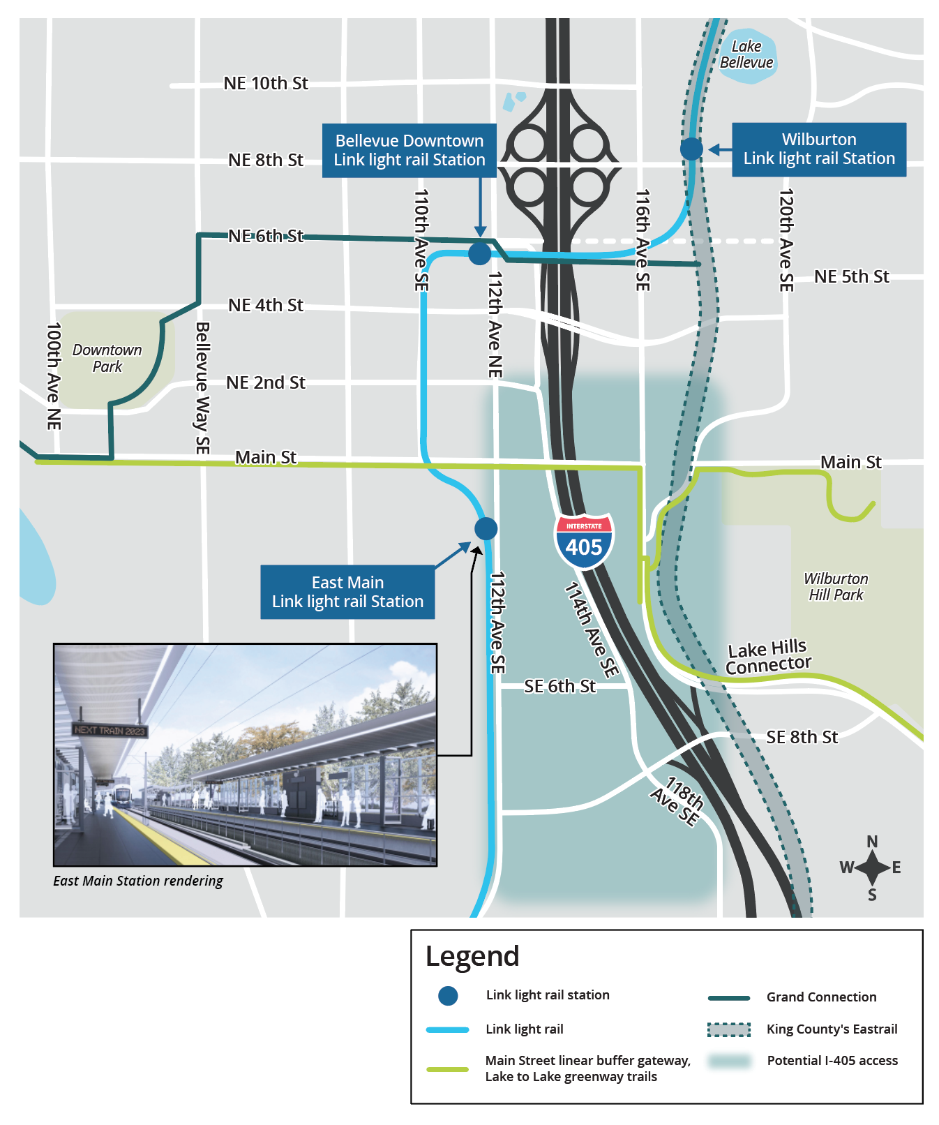
- Lake Hills Connector southbound on-ramp
- Southeast Sixth Street extension and southbound on-ramp
- Southeast Sixth Street extension inside access (formerly called Southeast Sixth Street extension with express toll lane access to and from the south)
- Northeast Second Street extension
- No build (no new interchange)
The City Council will collaborate with the Washington Department of Transportation (WSDOT) and consider technical analysis and community input before selecting a preferred alternative. Ultimately, the state legislature has the decision-making authority to fund the project. More information about the study can be found on the South Downtown I-405 Access Study webpage.
Following this round of community engagement, the study team will present the analysis findings along with stakeholder and public input to the council in April for its consideration in selecting a preferred alternative. If you would like to receive a meeting agenda notice, go to BellevueWA.gov/city-council.
To learn more about our evaluation of each alternative, select the “View Alternatives” tab below. Submit your comments in the "Share Feedback" tab below. You can also ask a question. See our frequently asked questions (FAQs) to the right for answers to common questions we have heard.
Background
The city and WSDOT evaluated several interchange concepts, between Northeast Second Street and Southeast Eighth Street. We also studied the results of not building a new interchange, a no build option. This study stems from WSDOT’s I-405 Master Plan adopted in 2002. We conducted this technical analysis on two levels, or tiers.
Tier 1 screening
We evaluated 13 alternatives, including the no build option, under a fatal flaw screening. This process considered compatibility with Bellevue’s transportation and land use plans and polices, compliance with federal and state policies and feasibility of construction. Five alternatives passed the Tier 1 screening and advanced to the Tier 2 evaluation. In addition to feedback from stakeholders within the study area, we captured community feedback in the first online open house held in August 2020 (see the FAQ section to the right for main themes from the first online open house).
In September 2020, the council selected five alternatives, including the no build option, for further analysis.
Tier 2 evaluation
We evaluated the remaining alternatives on:
 | Alignment with adopted plans and policies |  | Impact on property development |
 | Travel time |  | Costs (right-of-way, design, construction, impact mitigation) |
 | Access and safety |
Stakeholder and community input are key factors in both screening processes. Please refer to the FAQ section to the right for more details about the evaluation process.
Thank you for your interest in the South Downtown I-405 Access Study. The consultation period for this online open house has concluded.
-
Lake Hills Connector southbound on-ramp
Share on Facebook Share on Twitter Share on Linkedin Email this linkThis alternative includes a southbound on-ramp from Lake Hills Connector to southbound I-405. It complements the existing I-405 northbound off-ramp to Lake Hills Connector.
Alignment with adopted plans and policiesTravel time (compared to no build)Access and safetyImpact on property developmentCost- Adds auto access only; no bike lanes and sidewalks, no east-west connection
- No significant policy conflict with the exiting land use and urban design policies
- Permanent impacts from shade, lighting, noise and water quality
- Saves 500 daily person hours
- Reduces intersection delay by six percent
- Restricts westbound left turns from Northeast Fourth Street onto I-405 southbound
- No property impact identified
- Added access to I-405 supports future economic development
$150 million -
Southeast Sixth Street extension and southbound on-ramp
Share on Facebook Share on Twitter Share on Linkedin Email this linkThis alternative elevates and extends Southeast Sixth Street over 114th Avenue Southeast and I-405 to Lake Hills Connector and builds an on-ramp to I-405 southbound. This new ramp would pair with the existing I-405 northbound off-ramp to Lake Hills Connector to form a half-diamond interchange. This alternative provides bike lanes and sidewalks on the new east-west connection.
Alignment with adopted plans and policiesTravel time (compared to no build)Access and safetyImpact on property developmentCost- Adds new access to I-405, multimodal with east-west connection
- East Main transit-oriented development plan did not envision a ramp at Southeast Sixth Street; requires policy amendment
- Likely temporary impacts to wetlands during construction
- Permanent impacts from shade, lighting, noise and water quality
- Saves 700 daily person hours
- Reduces intersection delay by ten percent
- Includes separate bike lanes and sidewalks along north side of Southeast Sixth Street extension over I-405
- Extending Southeast Sixth Street to Lake Hills Connector over I-405 removes direct connection between 112th and 114th avenues southeast.
- Planter strip and potential parking lot impacts along 112th, 114th, and 118th avenues southeast and Southeast Sixth Street
- Additional access to I-405 supports future economic development
$175 million -
Southeast Sixth Street extension inside access
Share on Facebook Share on Twitter Share on Linkedin Email this linkThis alternative elevates and extends Southeast Sixth Street over 114th Avenue Southeast and I-405 to Lake Hills Connector and builds direct I-405 express toll lane access ramps to and from the south. It provides bike lanes and sidewalks on the new east-west connection.
Alignment with adopted plans and policiesTravel time (compared to no build)Access and safetyImpact on property developmentCost- Adds new access to I-405, multimodal with east-west connection
- East Main transit-oriented development plan did not envision ramps at Southeast Sixth Street; requires policy amendment
- Likely temporary impacts to wetlands during construction
- Permanent impacts from shade, lighting, noise and water quality
- Saves 1,400 daily person hours
- Reduces intersection delay by seven percent
- Includes separate bike lanes and sidewalks along north side of Southeast Sixth Street extension over I-405
- Extending Southeast Sixth Street to Lake Hills Connector over I-405 removes direct connection between 112th and 114th avenues southeast
- Planter strip and potential parking lot impacts along 112th, 114th, and 118th avenues southeast and Southeast Sixth Street
- Added access to I-405 supports future economic development
$325 million -
Northeast Second Street extension
Share on Facebook Share on Twitter Share on Linkedin Email this linkThis alternative extends Northeast Second Street to 116th Avenue Northeast without ramp connections to I-405. It provides bike lanes and sidewalks on the new east-west connection.
Alignment with adopted plans and policiesTravel time (compared to no build)Access and safetyImpact on property developmentCost- Adds east-west multimodal connections
- No new freeway access to support growth
- Right-of-way needs reduce redevelopment potential
- Permanent wetland, stream, shade, lighting, noise and water quality impacts
- Saves 100 daily person hours
- Increases intersection delay by seven percent
- Includes bike lanes and sidewalks on the north and south side of Northeast Second Street
- Requires elevating Northeast Second Street over 114th Avenue Northeast and I-405 to connect to 116th Avenue Northeast
- Travelers must use Southeast Sixth Street to access properties along 114th Avenue Southeast
- Significant property impacts both north and south of Northeast Second Street on the west side of I-405.
- Does not add freeway access capacity to support economic development
$125 million -
No build (no new interchange)
Share on Facebook Share on Twitter Share on Linkedin Email this linkThis alternative assumes no transportation improvements. The city is using this baseline to compare other alternatives.
Alignment with adopted plans and policiesTravel timeAccess and safetyImpact on property developmentCost- Both the city’s Comprehensive Plan and WSDOT’s I-405 Master Plan call for a new interchange in the South Downtown area
- No new access to support growth
- Maintains existing conditions with no further critical area impacts
- This alternative establishes a baseline to compare travel time savings for the other alternatives
- Without adding access to I-405, the city and WSDOT expect congestion to increase and lead to more rear-end collisions
- Does not require acquiring property to build improvements
- No additional access to support future property developments
- No cost


Who's listening
-
Phone 425-452-2064 Email mjensen@bellevuewa.gov


Title VI

The City of Bellevue assures that no person shall on the grounds of race, color, national origin, or sex as provided by Title VI of the Civil Rights Act of 1964, and related statutes, be excluded from participation in, be denied the benefits of, or be otherwise subjected to discrimination under any City of Bellevue program or activity. Any person who believes his/her Title VI protection has been violated may file a complaint with the ADA/Title VI Administrator. For Title VI complaint forms and advice, please contact the ADA/Title VI Administrator at 425-452-6168.
ADA
For alternate formats, interpreters, or reasonable accommodation requests please phone at least 48 hours in advance 425-452-2064 (voice) or mjensen@bellevuewa.gov. For complaints regarding accommodations, contact City of Bellevue ADA/Title VI Administrator at 425-452-6168 (voice) or email ADATitleVI@bellevuewa.gov. If you are deaf or hard of hearing dial 711.